To
The Honorable Chief Minister
Punjab.
Sub: NEED TO FORM REAL TIME FLOODS ASSESSMENT COMMITTEE: FOR SOLUTIONS PERTAINING TO FUTURE PLANNED SUSTAINABLE DEVELOPMENT INCLUDING REDUCING LOSSES DUE TO FLOODS
Dear Sir
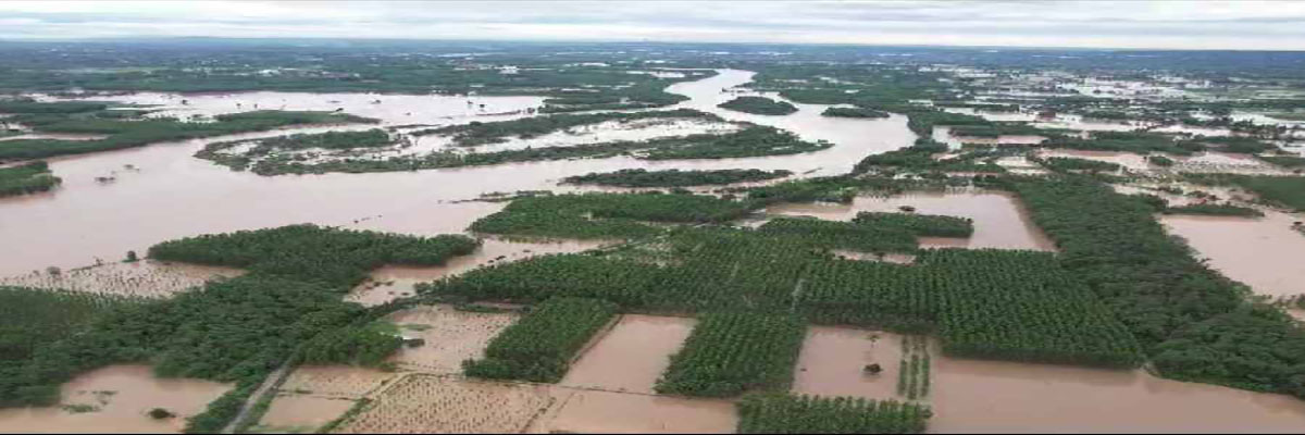
As the floods are a natural calamity and this is moment when relief and rehabilitation to the affected people is your top priority. But side by side we need to utilise this time to carry out detailed study of flooded areas of Punjab by an expert committee to be appointed by you with the mandate to assess and give report now in real-time basis say starting tomorrow rather than do guess work or rely on non reliable videos, picture or data for future planning based on following factors or points of interest
1.MAP ALL RIVERS IN FULL FLOOD : Map all the rivers of Punjab now when they are in full flood fury to assess the bundh weakness, impediments, the spots where legal or illegal mining should be prohibited to save the bridge pillars, road embankments, river banks and embankments from breaches which have led to losses of crops and houses in adjoining areas.
2.IDENTIFY FLOOD PLAINS : There is also need to identify the flood plains which can be used to nullify flood fury and their scale by diverting these water to deliberately created flood containg areas so as to save population centers. This will need serious on ground survey now in real-time.
3.MAP ALL WATER BODIES WHEN THEY ARE IN FULL SPATE : Map all choes, distribution Nallah’s and canals which require structural changes to improve the flood management including capacity and safety of the embankments.
4.IDENTIFY NEW STORAGE DAM SITES : New successive storage dams on all three rivers could be planned noting the present damage coefficient of the water bodies in relation to villages, cities and towns along water bodies. They will also help in water recharge of sub surface aquifers.
5. PLANNING NEW STORM WATER CHANNELS : As most urban areas have expanded beyond the planned limits and most do not have a separate storm water systems.Plan for new and alternative flood water or storm water channels to give relief to those staying near water bodies like Buddah Darya which always overflows and enters homes with its dirty raw sewerage water, chemical laden water and dairy dung waste water. This water body is narrow with embankments made of silt and garbage and is already overloaded and cannot take water beyond its capacity. So a need to take rain/storm water away from Buddah Darya to direct discharge in River SUTLEJ is a must and necessary outcome of the present reality assessment bon ground. And similarly action in Patiala, Mohali, Ropar and Hoshiarpur or other affected cities, towns and villages.
6. WATER HARVESTING PLAN : There is a very urgent need to have a state water harvesting plan to reduce the surface run off during rains as well as for recharging fast depleting under ground aquifers based on this real-time survey.
7.AERIAL DRONE SURVEY : The aerial survey and mapping of flooded areas of Punjab at this juncture will give better survey for future development of urban and rural infrastructure, suitable areas for various crops ,road network ,new urban areas development .
Hopefully you will take these suggestions in right spirit because mostly knee jerk reactions to developing situations are not well thought out. But we can plan, act and build infrastructure to meet next natural calamity a little better than today.Let’s not forget that due to climate changes these floods frequency might have short gaps as compared to earlier five or ten years intervals.
Regards
Yours Sincerely
Col Jasjit Singh Gill
Ex Member Punjab State Task Force on Budhah Darya Rejuvenation Project
